K
Kjetil
Nice wave om pic #29In this stage of our journey we reach the extreme North of Norway, our ultimate goal this trip. Re. our inspiration map, we have had to make some tough choices: we simply have no time to do it all! We decide to forget Varanger completely and visit Grense Jakobselv, Slettnes Fyr and the various North Capes, incl. Knivskjelodden.
Friday, August 27
Today we want to reach Grense Jakobselv. For players of 'Risk' a well know spot: a small spot where Norway borders on Russia directly. The road there ends at the end of the world, on the Barentsz Sea.
The route there has some hilarious moments, with lots of military presence and all sorts of prohibitions (see earlier post). The last few miles are on a dirt road, and then, at the end: the Barentsz Sea and a simple building belonging to the local boat club (?? Who? How??). It's a point for silent, philosophical contemplation.

But we have hardly arrived, in this complete stillness and emptiness, and then the following happens:

Two coaches come swerving around the corner to disembark a large group of students/youngsters on tour, who come here to lunch and swim! We flee on a walk towards the close by Oscar II Chapel:

Upon our return they have all left and we have this place to our own again. We put our van a bit higher up the rock, and have lunch ourselves:

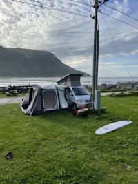
On our way back, just outside the military zone, we find ourselves a nice wild camp spot on a small lake, that just begs for a swim and a hair wash (with environmentally OK shampoo!!):


Saturday, August 28
From here we want to drive to Nordkyn, a half island, where Slettnes Fyr (Lighthouse) is. Many deem this the real North Cape: this is on the mainland (just!), where the 'commercial' North Cape is on an island. The purists say that if islands count, the real North Cape should be on Svallbard! On the road, we swerve towards Kirkeness. A dump, don't go there, ever. Waste of time. All we can say is that there was a Hurtigruten vessel moored there: Kirkeness is formally the end point of this line:

We see a few Hurtigruten tourists wander through this completely deserted little town. That it (and many other small places in Finnmark) is such a completely characterless concrete waste, is not their fault, really. In 1944, upon their retreat, the German forces burnt down everything in this province as part of their scorched earth tactic. So, everything here has this 'reconstruction' style: cheap concrete.
Slettnes is too far, we end up in Mehamn. We have another extreme here: the northernmost airport on the mainland. One can fly here from Amsterdam: 19 hours, 5 transfers, € 695 for a single trip, economy…

Sunday, August 29
We reach Slettnes Fyr, the northernmost lighthouse in Norway, on the Barentsz Sea again, and according to many the real North Cape:


We love Nordkyn, the half island the lighthouse is on! It is very rough terrain, the three little hamlets on it (Mehamn, Kjöllefjord and Gamvik) were not reachable by road until 1989, and now in winter still only through a system of column driving across the plateau. The landscape is barren, treeless, and reminds us of Iceland, with its ice rounded mountains.


We end up in Ifjord, where we set up camp and have dinner in the local trading post:

Monday, August 30
Now we're on the road to the 'commercial' North Cape. It's quite a drive, and we won't make it in one day. We aim for Lakselv.
On the road we see signs for a beautiful canyon, Silfar Canyon, where we make a short hike to visit it:
Tuesday, August 31
Last stretch towards the North Cape. Today we aim to go to the 'commercial' North Cape, visit and explore everything there, set up camp close by, and then the next day hike towards Knivskjelodden, a stretch of land that reaches some 1600 m further North than the commercial North Cape but can't be reached by car or coach, only by foot, and therefore never made is as commercial hot spot.


An there, in the background: the ridge of Knivskjelodden!

We set up camp in Skarsvåg, on the same island:


 And we start the second day of our Race to the South. We pass the Arctic Circle again:


