Buy all your VW California Accessories at the Club Shop Visit Shop

Small portable printers

Dottie

Dottie

VIP Member
Messages
504
Location
Perthshire
Vehicle
T5 SE 180
just planning my 2016 forays and am so far weighed down with OS Pathfinder books of circular walks.
I am pondering the possibility of using the web for suggestions but would have to print the results whilst away....would anyone have any thoughts on how best to do this....an A4 printer (wifi) might work....?
 
I use a canon pixma, simple, dropped it a few times and still works, obviously a bit slow but can leave it printing whilst doing other important tasks such as opening the wine bottle.
 
I don't have a Kindle (yet!). Would I download the info onto the Kindle then put it in my knapsack?
I usually take a map so a bit of paper would be easier, but maybe the Kindle option would save on buying a printer for the so worthwhile the weight in my knapsack?
Ah, but what if I don't get wifi......?!
 
Assuming you have some sort of smart phone, why print them? I've used Viewranger for many years on my phones. Originally on my Nokia and now on iPhone; Android is supported as well. You can buy OS 50000 & 25000 scale by areas such as National Parks, or just by the squares; or you can use Open-map which in many cases are superior to OS ones.

You can also download walks which other people have uploaded. You can plan routes on the phone or on the website and synchronise them with other devices.

One other thing I've found useful is saving the tracks of cycle rides and walks. These build up over the years and it's interesting to be able to see all the places you have been.

Website: http://my.viewranger.com

Alternatively you could photograph sections of your own maps and view them on your phone or tablet.

I've just parcelled up all my OS OS maps and stuck them in the loft! Someone will find them in years to come ... :)
 
I don't have a Kindle (yet!). Would I download the info onto the Kindle then put it in my knapsack?
I usually take a map so a bit of paper would be easier, but maybe the Kindle option would save on buying a printer for the so worthwhile the weight in my knapsack?
Ah, but what if I don't get wifi......?!
Yep. A kindle has a much better battery life than a phone (weeks) and you can view PDFs on it. Once you've downloaded the map on to it it's there, no further need for wifi. New maps on the go might be a problem unless you have a laptop or smartphone and a 3G kindle.

Else a smartphone (and maybe portable backup battery) with mapping software is a good option as you also have GPS and a weather forecast.

Or you could get OS maps and a compass for a proper analogue, retro experience.

Whilst I'm a lover of technology, personally I'd go with maps because once in a while I need to unplug from my devices.
 
When I'm walking the coast path I have a basic mini iPad, use mapmyrun to map prepare on it, Wi-Fi enabled so can get current location data.

My arthritic fingers just about manage with the size, anything smaller for me such as a smart phone is just too small, especially when raining, feeling cold, wind blowing, loo-needing and my last chocolate bar gone long ago.
 
Thank you all for all the info. Whilst ironing, I just realised I'd said a stupid thing: if I don't have wifi, neither would I be able to use any device...duh!
However, I like the idea of photographing the downloaded versions and taking kindle or iPhone with me....and a map! I walked off my pathfinder fail-safe route last year, had no map so couldn't figure out where I was, so I take books and map now, with compass....am I a dinosaur?!
I'll definitely try softwares mentioned. View ranger will be my next project...many thanks!

No you are not a dinosaur Dottie.

I always take an OS map and compass with me,

just me, but mist, fog, blinding snow or rain in hostile terrain requires a compass and murphy's law will always dictate that's when batteries go flat, WiFi ceases to work or the sun has a fit and all the local transmitting stations are knocked out by EMP.

Of course if Murphy is having a really good day that's also when I realise I have left my newly required reading glasses behind :sad
The whole reading glasses thing gives me the pip!
Still can't accept why I can't see what must still be there.
I have taken to photographing bits on my waterproof smart phone and zooming it in to make it big enough to be seen.
Smart phones, even waterproof ones don't work when the rain is so heavy it pools on the touch screen though...
So my point is: good old paper, map and compass tucked safely away in a waterproof map holder! Back to my printer research......
 
So my point is: good old paper, map and compass tucked safely away in a waterproof map holder! Back to my printer research......
Can't beat it.
Just can't always see it....
 
I have a small battery operated HP A4 printer that I liberated from work when I retired
connects either with a usb cable or bluetooth and takes up hardly any room in the bottom of the cupboard and even fits easily into the safe
Not tried it with a tablet as possibly cant get drivers for it but we use a 10in notebook pc so its a good combination
 
There are some great hand held GPS devices that let you download OS maps, but I suspect the smart phone can do all of that these days.
 
View attachment 11686
Assuming you have some sort of smart phone, why print them? I've used Viewranger for many years on my phones. Originally on my Nokia and now on iPhone; Android is supported as well. You can buy OS 50000 & 25000 scale by areas such as National Parks, or just by the squares; or you can use Open-map which in many cases are superior to OS ones.

You can also download walks which other people have uploaded. You can plan routes on the phone or on the website and synchronise them with other devices.

One other thing I've found useful is saving the tracks of cycle rides and walks. These build up over the years and it's interesting to be able to see all the places you have been.

Website: http://my.viewranger.com

Alternatively you could photograph sections of your own maps and view them on your phone or tablet.

I've just parcelled up all my OS OS maps and stuck them in the loft! Someone will find them in years to come ... :)
OS maps have a deal on in February if you trade in old paper maps. An alternative to keeping them in the loft perhapsView attachment 11686
 
That's the incentive I need to clear out the map drawer that's stuffed to the gunnels!
Fantastic!
I totally agree and I'll be passing the message onto my Father. He lent me a map a few years ago when I 'led' a Sunday ramble. We got horribly lost and bogged down in a forest, then some bright spark asked how old the map was: 1973...there was no forest in the way in 1973!:(
 
Looks like you should send them 1 at a time for maximum value vouchers.
2 at a time = £3.00 so no loss .... I wonder if there is a catch if you send them in twos?
 
Looks like you should send them 1 at a time for maximum value vouchers.
That's the incentive I need to clear out the map drawer that's stuffed to the gunnels!
Fantastic!
:bananadance:thumb:bananadance:):bananadance:D
Oh yes. 48 maps out of the drawer most circa 1987 - 1992 the university years and the beyond. Some of them look like I walked on them not with them... mainly 1:50k that we now have 1:25k of. Lots of lovely memories of lying on the floor scheming trips with himself and the cat. :)
The drawer is still full but at least I don't need a crowbar to get them back in...:headbang

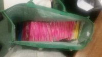
20160131_163433.jpg

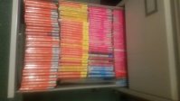
20160131_163810.jpg
 
Just loaded Viewranger on iPhone but think I'll load it on iPad to learn it....will print the manual at work today...looks like hours of fun....sometimes don't you wish there was a course on things? Ah hah....You Tube....will head in that direction and see what I can find. (Thanks Ewan for pointer to Viewranger)
 
Back
Top